 " />
" />


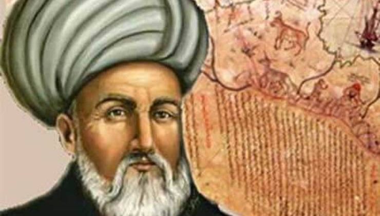

Muhiddin Piri was born in Gelibolu, one of the important centers of Turkish navigation between 1465 and 1470 The exact date of his birth is not known His father was Hadji Mehmet, and his uncle was Kemal Reis, one of the famous captains of those times He started working as a pirate when he was 11, and then he sailed together with his uncle Kemal Reis, who entered civil service and took part in various sea battles between 1487 and 1493
It is because of his success in the wars between 1499 and 1502 that he was first mentioned separately in Turkish navigation history At the same time, he may have seized the map of Colombus in one of the wars against Portuguese
In 1511, he left seas upon his uncles death and turned back to Gelibolu; engaged in map drawing, and then entered into service of great Turkish sailor Barbarossa (1476-1546)
During seizure of Egypt (1516-1517), he came out much successful with ships under his command in occupation of Alexandria, which was an important sea base Such success helped his introduction to Sultan Selim (1517-1520) and his presentation to him the world map which he completed in Gelibolu in 1513
After Egypt expedition, Piri turned back to Gelibolu and started to work on The Book of Navy Some chaos emerged in Egypt at the same time It was agreed that Piri should guide the navy to be sent to Egypt to take Pargali Ibrahim Pasha there to put down the rebellion A storm broke out during the campaign and ships had to take shelter in Rhodes for a period of time Such event provided the opportunity for Piri to meet Pasha Pargali had noticed that Piri Reis used frequently some notes, which was the book he was preparing, during the campaign and wanted him to turn these notes into a book As a matter of fact, Piri completed this book and presented to Sultan Suleyman at the hands of Ibrahim Pasha The Naval Book attracted admiration of the Ruler It was succeeded by the second world map only the first part of which now we have in hand, called the map of North America Portuguese seized Aden at those times Ottoman State commissioned Piri Reis as Indian Captain and wanted him to take Aden back Piri took Aden back in 1548 and made invasions at the shores of Umman Sea
His successes made his enemies angry Basra Emir informed Istanbul that he left the navy in Basra Upon Egypt Governor Dukayin-zade Mehmet Pasha’s agreeing with his idea, Piri Reis, who was over eighty, was executed in Cairo in 1555
First World Map of Piri Reis
As far as we found out from a note on this map which shows Southwestern Europe, Northwestern Africa, Southeastern and Middle America shores on a parchment with 90/60 size, which was found in Topkapi Palace in 1929, it was the part of a big world map he drew in Gelibolu in 1513 and then presented to Egyptian Sultan Selim in 1517 (1512-1520)
The map showed mountains in embossed design, the rivers were shown with thick lines, stony places were black, sandy and shallow places were shown with red points, stony places not visible in the sea with crosses The map was embellished with common plant, animal pictures, and notes about regions
This was a map which aimed at introducing shores and islands without latitudes and longitudes There are two compass roses one in the south and one in the north instead of latitudes and longitudes Lines dividing each compass roses into 32 sections extend along the map, with two tables showing vemin sections The lines and scales from wind roses are useful for measuring the distance between ports
In general, this map was thought to lack mathematical foundation However, investigations showed that in Piri Reis’ map, there were five projection centers on Atlantic Ocean Latitudes and longitudes can easily be drawn on this map Anyway, he told in his Naval Book that this map was drawn very carefully and that any mistake no matter how small would mislead the users of such map and that such map should not be used
Piri Reis took advantage of 34 maps The dates of 20 of those are not certain 8 of them are maps called Caferiye by Muslim geographers 4 of them are new maps drawn by Portuguese: 1 is Columbus’ map He says about this issue in his Naval book:
Ol kitabıyla ider iyâd
Dahi sonra durmaz açar ol ili
Hartısı ta kim geldi bize
Varup Antilyeyi ider aşikâr
Şimdi meşhur eylemiştir ol yolu
İş bu zor kim dedim cümle size
One of the notes on the map also reveal that a Spanish person who was taken captive by Kemal Reis and who had taken part in three of the four travels of Columbus gave much information about Columbus’ discoveries
Since Columbus’ map is lost, the only original document we have is this map of Piri Reis Piri remained faithful to the map by Columbus while drawing American coasts and repeated it in many points Antilles and Cuba Island in the Map were shown as a continent in line with the claims of Columbus Columbus believed that Cuba coasts comprised a continent when he was there in 1494, and made Notary Fernand Perez de Luna, who was in the ship, write that He also made the crew sign this document This document dated 12 June 1494 stated that each crew who agreed and signed that Cuba was a continent would be fined 10000 maravides apart from his tongue’s being cut In addition, Piri called an island “Kalera” since Columbus named a cape in Trinidad as “Kalera” Haiti, which was called Spanish, was shown as Spain Island by Piri 12 islands to the southeast of Haiti were called Undizi Vergine He used Italian, the native language of Columbus instead of Spanish Onze word
In addition, Columbus showed South America as a group of islands Piri, being inspired with that, drew many imaginary islands with parrot pictures on, across Trinidat island
He made use of new Portuguese islands while drawing South America Those were maps drawn by America Vespuci, Pinson, Juan de Solis until 1508 Moreover, some of the place names in South American coasts are similar to their names today The places of primary rivers in these regions such as Santa Agostini, San Megali, San Francisko, Porto Ralli, Totel Santo, Abroklok, Cab Frio, Kantenio are shown, but their names were not written It is interesting that La Plata river, which did not attract attention of Pinzon and Juan de Solis, was shown on the map His extending south of South America toward east shows Batlamius effect As a matter of fact, Naval Book showed south of South America as sea, not land
There are pictures of ships on the map Those were drawn to show the discoveries of the travelers For example, the note next to the ship picture in the vicinity of Santianio Island states that a Genoese named Nnaton had discovered this island To the north of Guinea, there is the picture of a big ship picture with a woman and a man lighting fire on fish three people, a boat and three people ahead illustrating Santo Brandan myth Piri indicates that he took these myths not from Portuguese but old Mappa Mundis
The map bears historical value because of its being drawn in terms of much of a scientific approach for its times and because it is the only map drawn using Columbus map of which today we have neither the original nor a copy
Second World Map (1528)
15 years after drawing of the first map of Piri Reis in 1528, a second World Map was drawn in Gelibolu again Today we have a 68/69 cm undersigned part of it This part contains north Atlantic Ocean, the coasts of North and Middle America discovered at those times
The map starts with Greenland in the north The first land toward south was called Bakala and the lower one was named Terre neuv, with an indication that those were discovered by Portuguese Florida peninsula, named St Batisto by him which is drawn very accurately follows that It was added to Porto Rico in the previous map The lands on the side are Honduras and Yukatan peninsulas discovered in 1519
Cuba and Haiti were drawn very accurately Isl di Vana was written on Cuba Island The mistakes on the previous map were corrected
There are wind roses divided into 32 equal sections instead of longitudes and latitudes in this map too According to two scales divided into 20 parts and the explanations, the distance between the parts is 50 miles, and between the points is 10 miles Tropic of Cancer, which was not visible in the previous map was drawn and named günuzadısı It was drawn over Cuba Island More correctly, it should have gone over a little more to the north
There are some mistakes on the map compared to today’s maps This is because of not taking into consideration the position of 10-13 degrees in the compasses of those days All maps of western origin bear the same mistakes too
The coasts of this map are drawn much more successfully compared to the previous ones, some blank places were filled and some were left blank This shows that Piri had a scientific approach and he followed discoveries on time and step by step We can say that this map is one of the most successful maps with regard to map technique drawn in that century.